Feb.
26
2021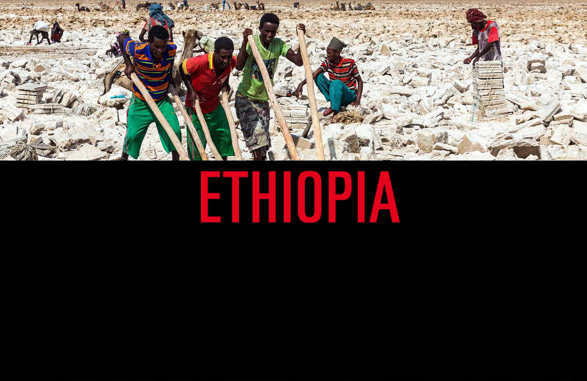
South and North Ethiopia, the Omo Valley and the Danakil Depression
First the South
In 2006 I went to Addis Ababa and from there to the Omo Valley. It wasn´t easy to go there. Roads were difficult to pass, bridges broken, it was wet, muddy and very slippery, you had to improvise a lot. Meeting the ethnic groups there is an amazing experience, however, it makes you think about what you are doing there. The pictures shown here are scans from slides.
Then the North
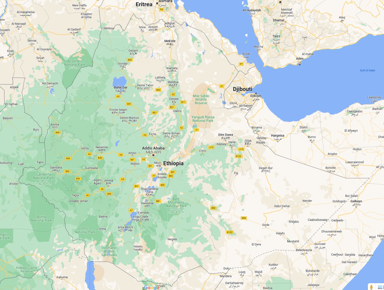
In 2017/2018 I went from Addis Ababa to the northen parts of the country. I also went to Djibouti, but pictures from there are not included here. As Ethiopia is one of the most diverse countries you can find, the North es extremely different from the South, but as amazing as anywhere there. If you love colors and heat, you have to visit the Danakil Depression around Dallol and the volcano of Erta Ale.
Feb.
26
2021
 Going to Eastern Australia and to the Center

This was a trip long time ago, over Christmas and New Year 1993/1994 to Eastern Australia and then shortly to the center. Therfore all pictures shown here are scans from slides.
That trip started in Cairns and then we went by car all the way down along the west cost to Melbourne.We visited, among others, the Great Barrier Rief, still healthy then, Daintree National Park, Fraser Island, Byron Bay, Surfers Paradise, the Blue Mountains. And when go to Sydney don´t miss the Sydney Rock Oysters.
From Melbourne we went to Tasmania, arriving there on Christmas Eve. It wasn´t easy to find a car and accomodation and an open restaurant. And it was a pretty cold summer there, around 5°C. After going back to Melbourne I flew to Ayers Rock. I don´t remember that climbing Ayers Rock was under discussion then, but I won´t trust my memories too much. So I went to the top on New Year´s Day for the sunrise. You can see another picture here: Landscape.
Okt.
16
2020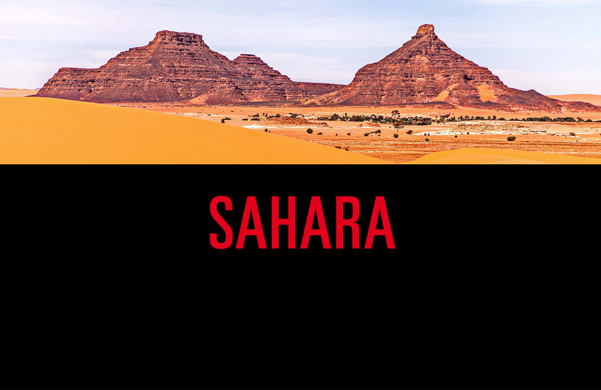
Two trips to the Inner Sahara Desert
First: Algeria
In 2002 I went for the first time to the inner Sahara desert. It was in southern Algeria, the area of Tamarasset, Djanet, the Hoggar mountains, the Tadrart Rouge and Tassili n´Ajjer. I had to idea what to expect and was totally stunned by the scenery, not only dunes, but also mountains which reminded me of Monument Valley in the US.
At that time I still took slides, so the pictures you see here are scans from these slides. There is something I didn´t and wasn´t able to catch with my camera. First, the fantastic sky of the Milky Way, at times full of shooting starts. And second, the absence of sound. You don´t know how quiet it can be, if you haven´t been there.
Another thing I didn´t expect the way it turned out was the weather. It actually was raining a few times. Some people on the tour came without a tent, that was a real problem then. And because of the rain, our cars often got stuck in the water and wet underground. Otherwise the temperatures were quite comfortable, never too hot and not too chilly at night. And it´s not only the landscapes which were awesome. Also the ancient painting and carvings, the rock art, was fascinating.
Then: Chad
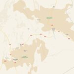
After that tour to the Algerian Sahara I was sure, that I´ll go again to see the desert at a different place. However, it took me until 2019 that I finally went again – to Chad. The main destination was the Ennedi Plateau. And again, it was an awesome trip. The landscapes, the people, the way of travelling, the whole package, simply sensational. The weather was pleasant again, no rain this time, but one moderate sand storm. It´s not easy to travel in Chad and not everywhere it´s safe. And it takes time, it´s not a small country. Some day I also want to experience the Tibesti Mountains. But to see this extremely inaccessible area you´ll need a lot of time, much more than the two weeks for this tour.
So, of course, I want to go again to the Sahara. To Tibesti in Chad or to other areas and countries in this vast desert. Let´s see when this will be.
Juli
19
2020More New and Old Pictures from All Over the World
And now new uploads just after less than one month…
The new entries are in the portfolio categories Nature (Water, Ice and Animals) and Street Photography. Within these, Ice and Street Photography-3 are completely new categories. Again, you´ll find older and newer pictures. The earlier ones, again of course, are scans from analogue slides.
Here are the new links:
Juni
27
2020New and Old Pictures from All Over the World
A new entry after more than one year…
As bad as it is, Corona gave me time to look through my collections of pictures and to upload a few of them into several categories. More will follow hopefully not so late after this.
You can find new entries in the portfolio categories Nature (Cats and Trees), On The Way (Outside-In) and Street Photography. These pictures were taken between 1988 and 2019, the earlier ones, naturally, are scans from analogue slides.
Here are the links:
Juni
02
2019
Ghana, Togo and Benin in Western Africa
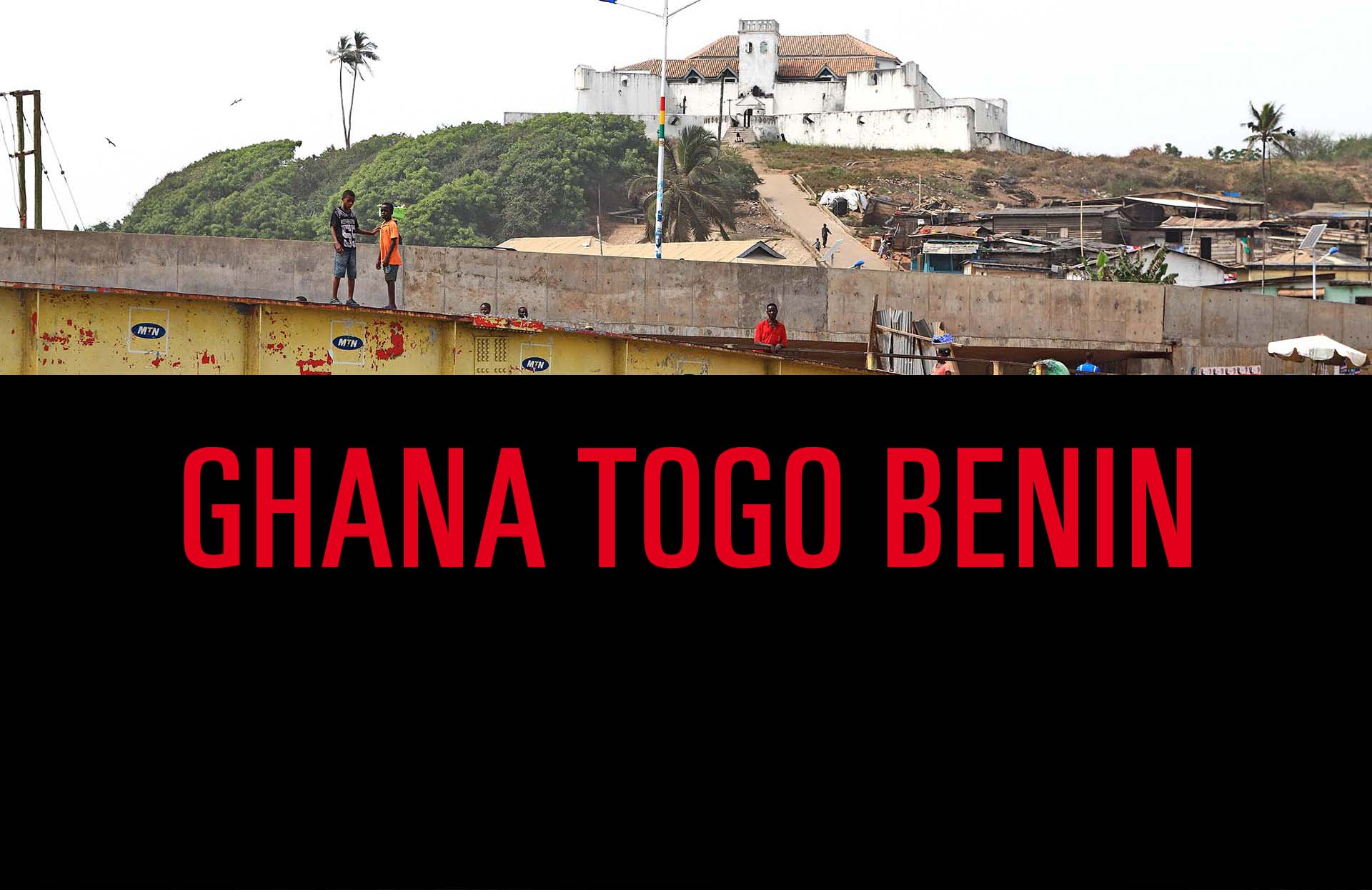 From the end of December 2016 to the beginning of January 2017 I visited the neighbouring countries of Togo, Benin, Togo and Ghana in Western Africa. The only times I´ve been to Western Africa before was in 2013 to Cabo Verde, and very long ago to Mali (when it still was a safe country to visit).
Touring Western Africa is always some kind of adventure. It´s not the place to go if you are looking for a relaxing holiday. Although there are 5 stars hotels at the beach where you could do just that. At the end of the tour I stayed in such aplace in Ghana´s capital Accra because my flight was delayed.
It´s a kind of adventure for a tourist because there is not so much touristic infrastructure. The concept of tourism isn´t really something of importance there. One example are the Royal Palaces of Abomey, you´ll realize that, when you are there. However, or because of that, you´ll get a deeper feeling for the countries and their people – as much as it is possible to experience in a too short time.
In Ghana the major stations were Accra, Cape Coast, Kumasi and Tamale. In Togo it were Lomé, Sokode and Kara, in Benin Ouidah and Abomey.
There is much to learn about the history of the slave trade, it´s deeply impressive and depressing.
Fascinating is everything around voodoo, the temples and ceremonies associated with it. But I had not enough time to get anything more than a superficial glimpse into that culture.
And when you travel there, don´t forget to try the local food, especially when you are travelling with an organized tour.
März
10
2019Usually when I add a new series of photos I´ll take another one out so that the website will not look too crowded. Still, there are a few photo series which have been there from the beginning. Yemen is one of those.
The pictures I took are from 2008. Yemen today is different – what would I see when visiting the places of which I took pictures again today. I don´t know.
When reading or listening to the news in Germany, I rarely encounter anything about the ongoing war there. Why not? And when Yemen is in the news then there is little in-depth information. Who are the fighting parties, what are they fighting for? Who are the acting persons or groups who are really responsible for the war? Why are we (our politicians) not helping the people of Yemen? To me most of the news on the war seem to be very biased. Is that so? If yes, why is that so? Please check for yourself, try to dig deeper, try to find out the answers.
Feb.
01
2019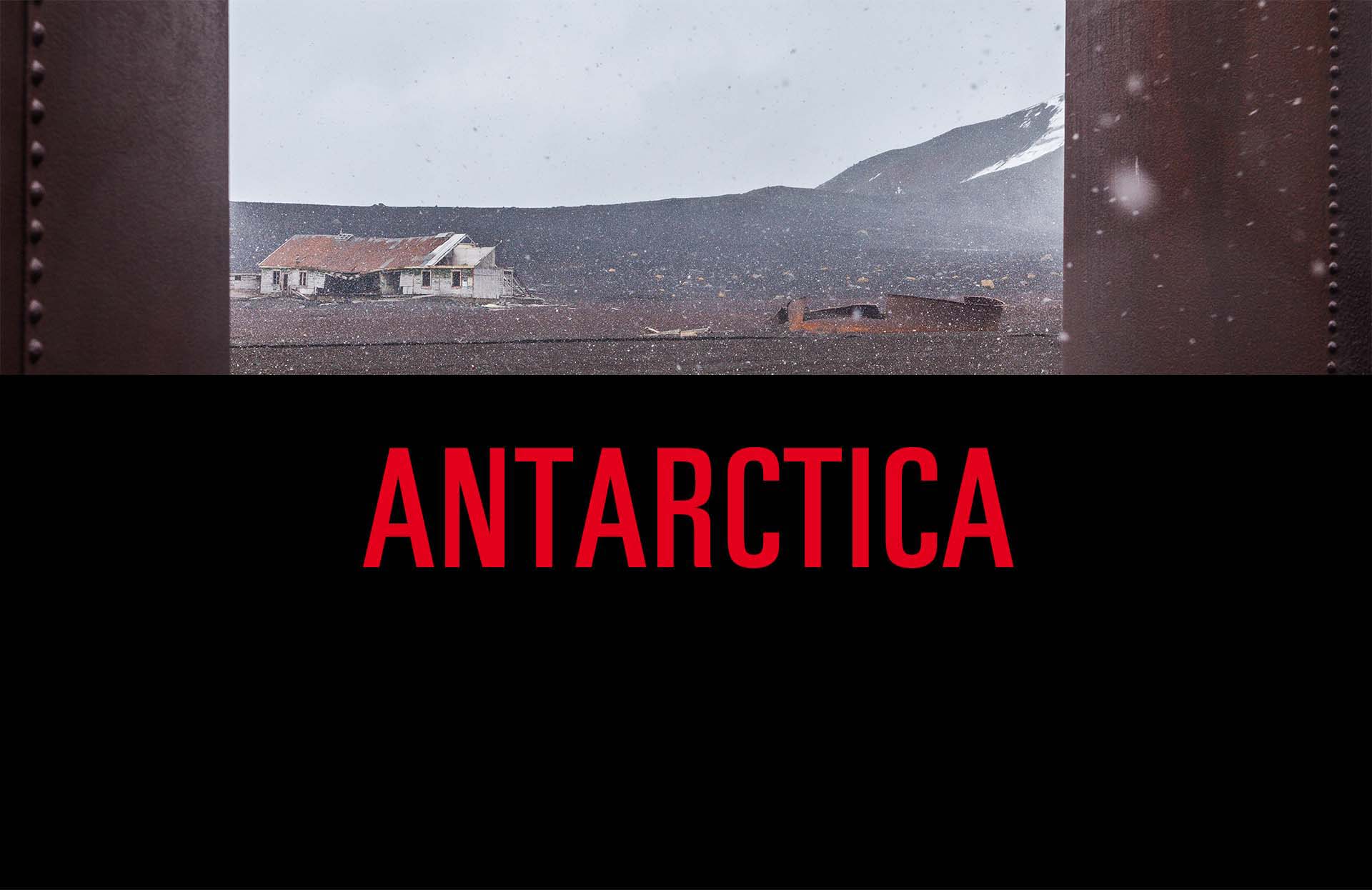
Far South
Antarctica from Ushuaia
In 2010 I took the route from Soutern Argentina to Antarctica. The cruise started and ended in Ushuaia. For me it was the second time to visit Ushuaia. The first time was in 1994 during a tour through Patagonia. (And that was more or less the first holiday with that I really began to travel.) Of course, when saying Antartica it means just the tip of that “continent”. Almost all tours don´t go much deeper and not really close to the South Pole.
It might be interesting to compare the pictures of the South with those from the North. One year before, 2009, I visited Greenland. And in 2004 I took an icebreaker to Franz-Josef-Land. This one is quite close to the North Pole and gives the best comparison to Antarctica. (By the way, the North Pole is easier to reach than the South Pole, it´s just pretty expensive.)
What are the differences between the South and the North? Here are the touristic ones: The animals are different, of course. There are many more tourists in Antartica than in the Artic. Therefore, in Antarctica you´ll meet other ships and people, that´ll happen very rarely in the far North. And the ice is different. For example, you´ll see many more icebergs in the South. And at least for that tour that I did you don´t need an icebreaker, but for the far north it´s necessary.
When travelling, the weather always is a big topic. As you can see, the weather was pretty nice most of the time. Only on Deception Island is was very windy, it snowed and the skies were grey. And exactly there you could swin in the ocean, what I didn´t do, of course(?). Otherwise it was perfect, and the local summer isn´t that cold.
It´s far away, from Europe, but you have to go there at least once!
Nov.
18
2018
Travelling to Myanmar in 1993
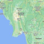
1993 in Myanmar
This is another old series from a long time ago visit in 1993 (https://www.google.de/maps/place/Myanmar). The pictures were taken as slides, as I usually did before the digital age. Myanmar is one of the most colorful coutries I´ve seen so far, certainly with the most gold around. And the density of pagodas is simply amazing.
At that time, in the early 90s, only few tourists were in the country, hotels were also very few, electricity was limited and frequently breaking down. Fridges existed, but without electricity they were merely containers, that was the time when I learned to enjoy drinking warm beer. Travelling was done by train, hired car with driver (very good!), and airplane. If you wanted to use the fast way to your next destination, for booking you had to go to the airport one day before your flight, earlier bookings were not possible.
If you travelled to Myanmar recently you may recognize some of the places where I took the pictures here. Does it still look the same, how much has changed?
You can also compare the pictures to the series Vietnam and Cambodia, where I also went in 1993. How do you think about the changes there?
Feb.
10
2018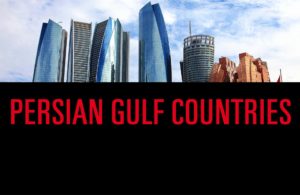
In Kuwait City, Manama, Doha, Abu Dhabi and Dubai
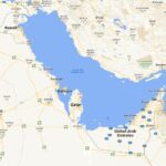
Persian Gulf States: Kuwait, Bahrain, Qatar and UAE
After being to Dubai Airport many times it was about time to see the city. At the end of 2015 I combined some of the Persian Gulf States (or: states of the Arabian Gulf) in this trip, including Kuwait City, Bahrain´s capital Manama, Doha in Qatar, and Dubai and Abu Dhabi of the United Arabian Emirates. (https://en.wikipedia.org/wiki/Arab_states_of_the_Persian_Gulf#/media/File:Arab_Gulf_States_english.png)
December is a good time when you want to walk around, it´s not hot, in Dubai it was sometimes even kind of slightly cold. And walking around is perfectly possible, also in Dubai contrary to what some guidebooks are telling. And a nice challenge in Abu Dhabi to find out the correct names of the streets. A highlight of Christmas Eve was the view from the top of Burj Khalifa. But that´s just one of the obvious highlights around.